Route line & utility location surveys

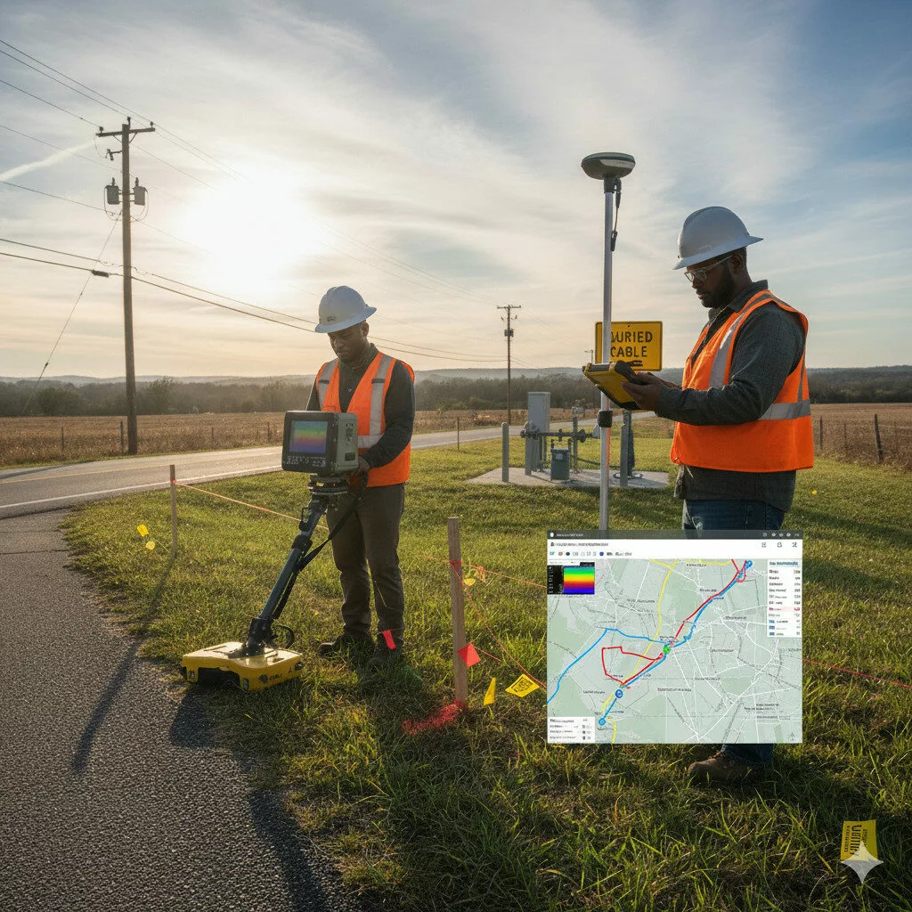
Route Line & Utility Location Surveys

Before you build, know what’s below.
We conduct route alignment and underground utility mapping to support safe and efficient project execution.
Our services identify existing utilities such as water lines, cables, and drainage systems — minimizing risk during construction.

Outcome: Reduced project delays, safety hazards, and rework costs.

Similar Posts

  • GIS Applications

    Leverage the power of spatial intelligence.We offer GIS-based solutions for data visualization, mapping, and analysis that enhance planning and asset management.Our GIS team provides: Outcome: Actionable spatial insights that drive smarter infrastructure decisions.

  • Geodetic Ground Control

    Geodetic controls are the cornerstone of accurate mapping and construction.We establish high-precision control points using GNSS and total station methods tied to national or global coordinate systems. These serve as reliable references for all future surveys and construction work. Outcome: Consistent, precise, and reproducible survey data across all project phases.

  • Base Map Preparation

    Every infrastructure project begins with a strong base map. We combine survey data, satellite imagery, and GIS tools to produce precise base maps for towns, development sites, and industrial layouts.Our maps capture all relevant spatial features, providing a dependable framework for land-use planning, zoning, and design. Outcome: Accurate and layered base maps that improve planning…

  • Mining Surveys

    Mining operations rely on precise spatial data — and we deliver it with confidence.Our mining survey services include: We use high-accuracy instruments to ensure safety, efficiency, and compliance in all mining environments. Outcome: Optimized extraction, improved safety, and minimized operational costs.

Leave a Reply

Your email address will not be published. Required fields are marked *