
Mapping the Future: How Modern Surveying Technology Is Transforming Infrastructure in Ghana
Introduction
Infrastructure is the backbone of national development. From roads and bridges to urban planning and mining operations, every project begins with one essential step — surveying. In Ghana, the rise of advanced surveying technologies like drones, GNSS, LiDAR, and GIS is redefining how we plan, build, and manage the built environment. At FMB Engineering Limited, these tools are central to how we deliver precision and progress.
The Evolution of Surveying
Traditional surveying relied heavily on manual instruments like theodolites and chains. While effective in their time, these tools were limited by human error and terrain challenges. Today, digital transformation has changed the landscape.
Modern surveyors now deploy Global Navigation Satellite Systems (GNSS), drones (UAVs), and 3D laser scanning to capture vast areas of data with millimeter accuracy — all in a fraction of the time.
Drones and Aerial Mapping
Unmanned Aerial Vehicles (UAVs), or drones, have revolutionized topographical surveys. They enable aerial data capture from remote or hazardous areas, producing orthophotos, digital elevation models, and 3D site maps.
For FMB Engineering, drones mean faster turnaround, higher accuracy, and safer operations — especially for road alignment, mining pits, and large-scale land mapping.
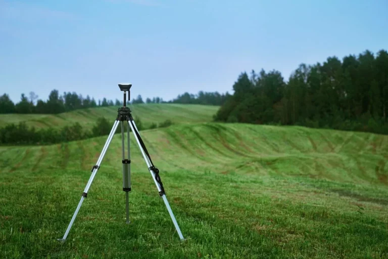
GNSS and Geodetic Control
Precise positioning is key to every engineering project. GNSS (such as GPS, GLONASS, and Galileo) allows surveyors to establish geodetic control points that serve as accurate spatial references. These control networks are essential for mapping, construction, and monitoring land deformation over time.
FMB’s survey team integrates GNSS with total stations and digital levels to maintain precision at every stage of a project.
LiDAR and 3D Modeling
Light Detection and Ranging (LiDAR) technology captures millions of data points to generate high-resolution 3D models of terrain and structures. This enables engineers to visualize site conditions before a single machine breaks ground.
In road design, LiDAR improves gradient calculations and cut-and-fill accuracy — saving time, materials, and money.
GIS Integration
Data from these technologies feeds directly into Geographic Information Systems (GIS), where it’s analyzed, visualized, and stored. GIS maps turn raw survey data into actionable insights for planners, engineers, and policymakers.
At FMB Engineering, this integration supports smarter urban development, utility planning, and land management.
The Impact on Ghana’s Infrastructure
From the Eastern Corridor roads to mining operations in Tarkwa and Obuasi, modern surveying ensures better project outcomes. Accuracy reduces construction errors, improves drainage design, and enhances safety.
Ultimately, technology is helping Ghana build resilient infrastructure that stands the test of time.
Conclusion
As Ghana continues to expand its infrastructure footprint, FMB Engineering Limited remains at the forefront of this technological evolution. Our investment in modern tools and skilled professionals ensures that every project is built on data, precision, and trust.
FMB Engineering — Mapping the Future, Building with Precision.